This reporting tool creates an image of the terrain, and any vegetation, between an environmental sensor and a wind turbine.
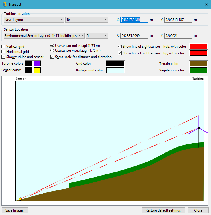
This tool is intended to help in cases where users are trying to explain the visual impact of a project or to investigate the behavior of the noise model. The two different sensor heights are due to the ability in the software to independently set the sensor height for either visual impact or noise.